- 510 Posts
- 93 Comments


 2·10 days ago
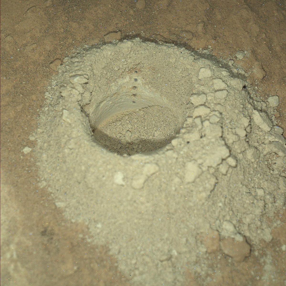
OK, now I understand. They could be noise caused the lengthy night time exposure, or some dark inclusions in the host rock that was drilled. I’ll check to see if they appear in any other images, if so that will rule out noise, but if they are liberated inclusions from the rocks substrate, then we’ll likely never know what they are if the team decide not to investigate them.
Those are small pits made by laser shots from the ChemCam instrument. Each strike of the laser causes a tiny flash of light, that light is picked up by a telescope inside ChemCam and sent to three spectrographic analysers inside the rover. The data from the analysis can instantly record the chemistry of the rock (or sand) identifying its constituent elements and the percentages of each element present. The laser has been fired well over a million times at targets in Gale crater.

It sure has :) - Read all about it here -
deleted by creator
 6·23 days ago
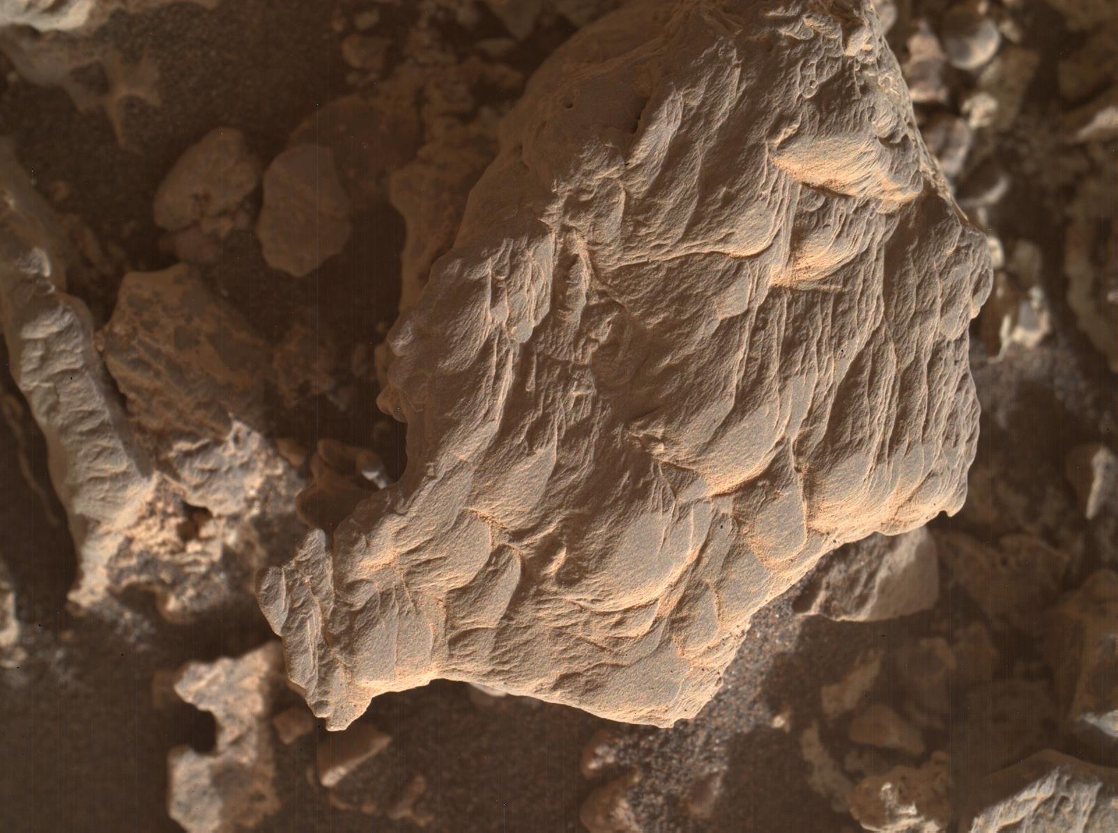
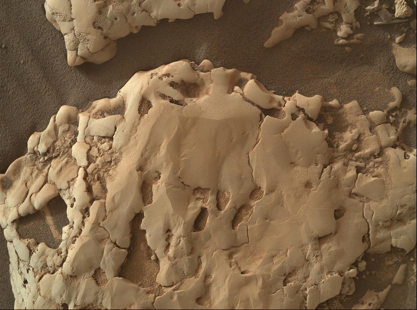
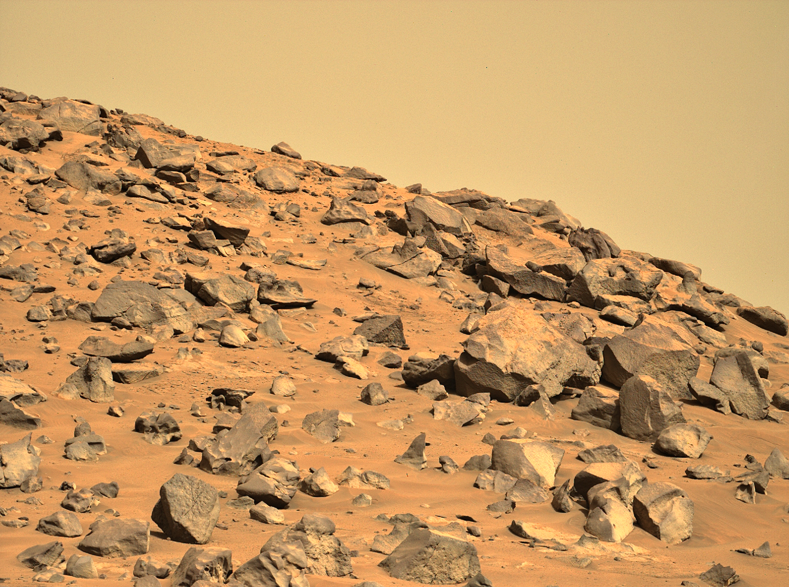
Just a feeling based on the fractures, that’s why I put it out there and asked the question. When we’ve seen mineral filled fractures in rocks on Mars the fractures have usually been in fairly straight lines following the crystalline structure in the host rock, or at separations of the sedimentary layers. It could be an optical illusion, but many of the fractures are far from straight in this target, almost like series of large crystals in a honeycomb like arrangement. The appearance of sandstone could just be a dust covering. Appreciate the feedback :)
Looking forward to hearing how the team call this float rock :)
Edit: fixed typo
I don’t have tools to scale these images properly, but I estimate the fractured rock is around 50cm to 75 cm wide
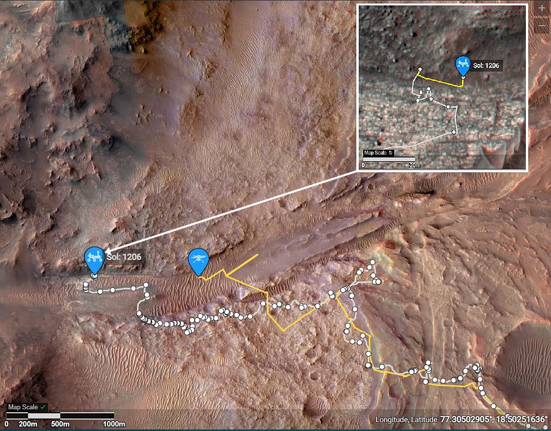
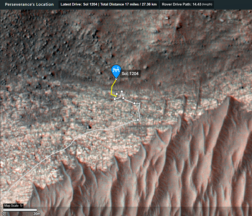
The way I’m reading it is the AutoNav drives were definitely taking us in circles because of the difficult terrain, so they decided to revert to drives within line-of-sight… i.e, they pick a benign path that they can see in the NavCam images, then program that for the next drive. These will always be shorter than AutoNav drives, but the line-of-sight drives are safer and we’ll reach Bright Angel for the next sampling opportunity soon enough…
You can also find thousands of calibrated MastCam-Z images on this link (without having to wait 6 months for the PDS versions : https://mastcamz.asu.edu/mars-images/images-videos/?item_type=natural-color-images
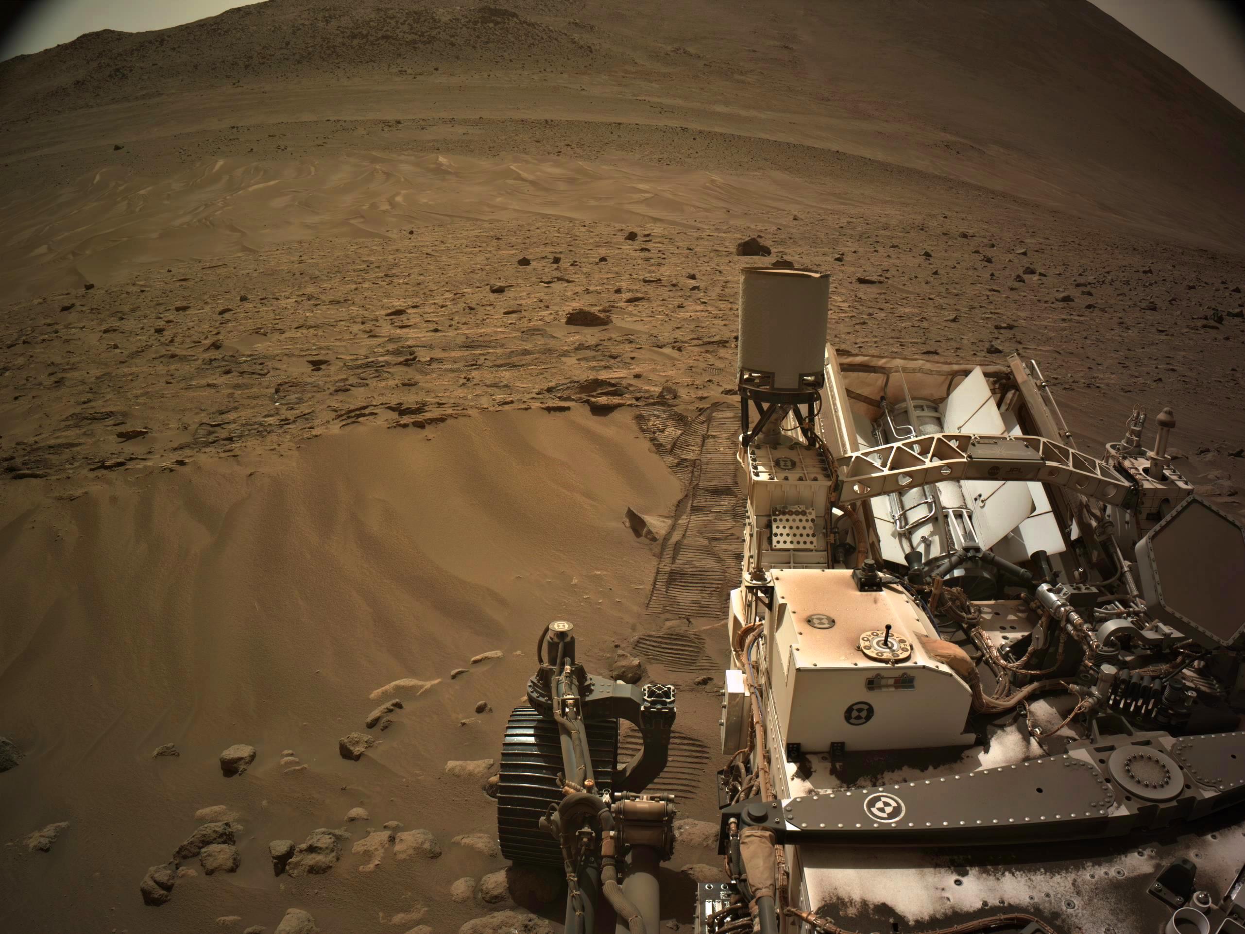
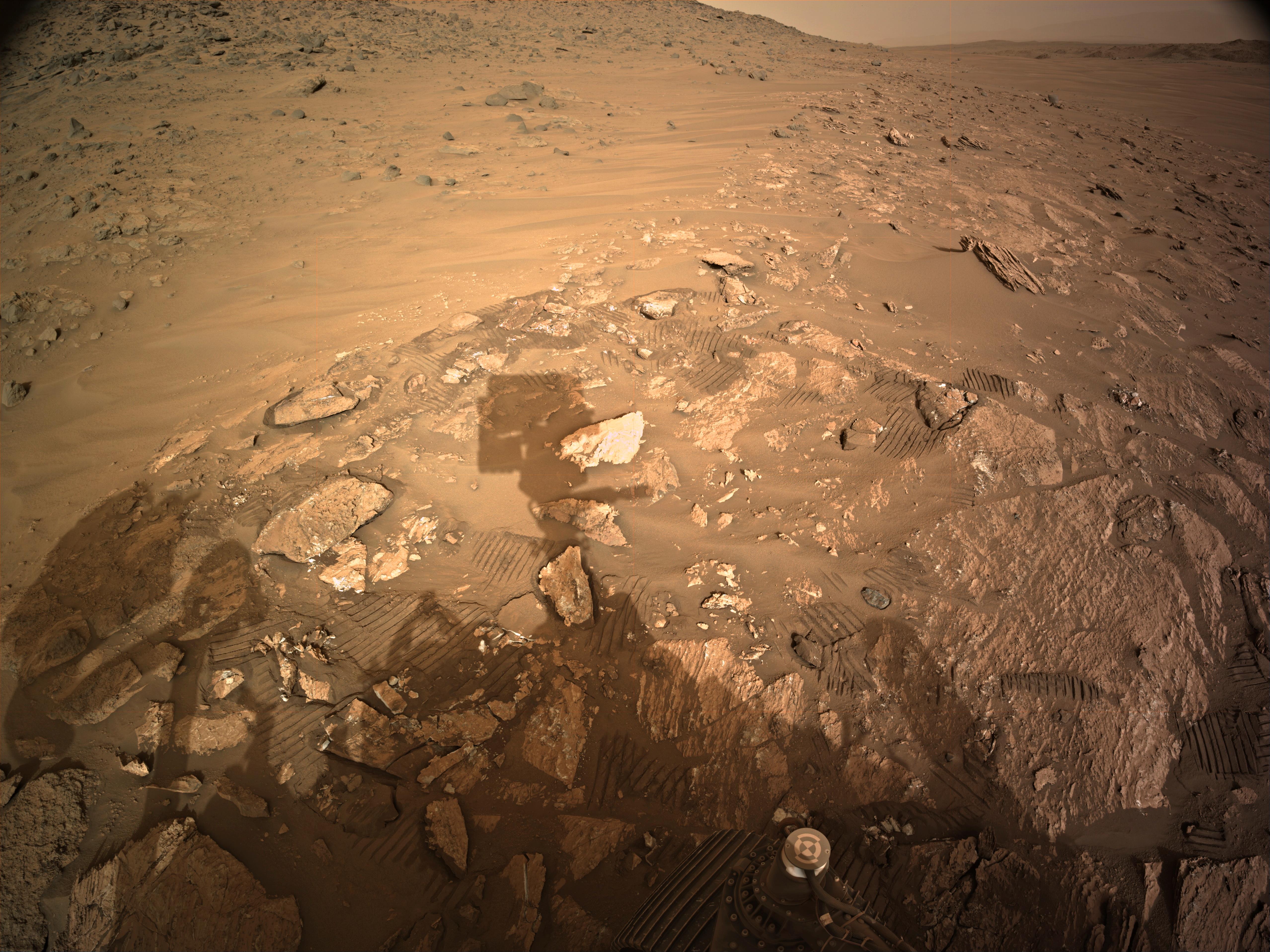
At the end of each drive the rover sometimes partially rotates to align its radio antennas towards Earth depending on mission priorities. that partial rotation is performed in place and can leave those nice tracks on the ground in sandy conditions. Knowing the diameter of the wheels and the number of grousers one can readily get a good feel of the scale of the terrain from spacing of those tracks. Getting the sun in the right place to illuminate that scene is just good luck. As a once budding amateur photographer I know what you mean about framing and those occasional artistic shots when everything aligns just right, that’s why the MSL B&W images really tick a lot of boxes for me, something colour images can rarely do for me, B&W images seems to portray the mood and tells the story better for me without the distraction of colour. Here’s an example from Curiosity that ticked all of my boxes a few thousand sols ago :) https://www.flickr.com/photos/105796482@N04/20323716143/
Been running this App for a looooong time, it works well, and it’s great to get those updates of new images
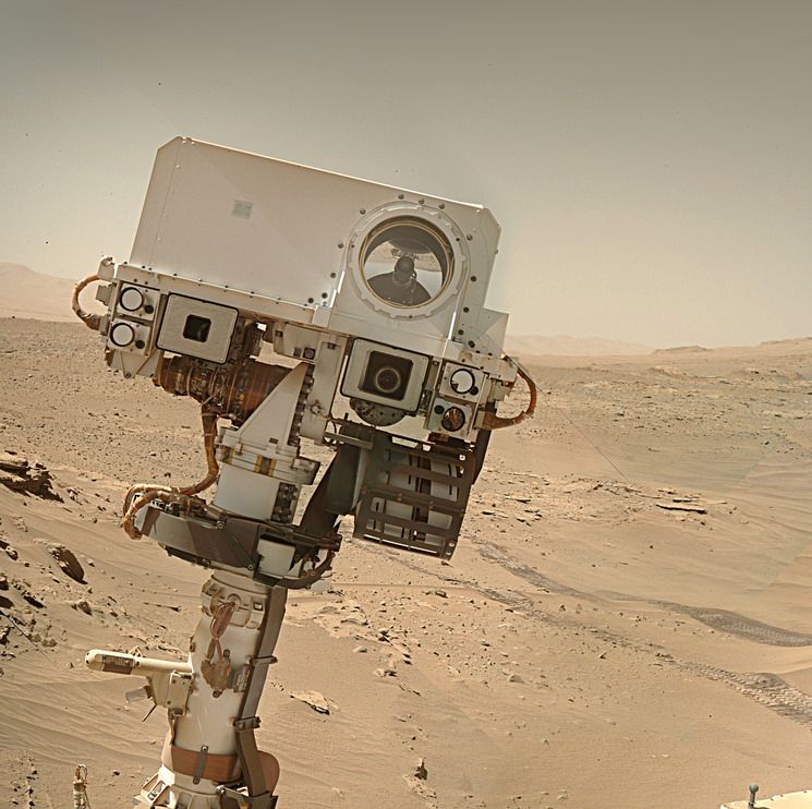
The rover operations team command the rover to take a full set of NavCam tiled images after ever drive, the example you posted here is a left navigation camera tile. A minimum of 4 tiles are required to assemble a full frame image from each camera, at leased 5 full frame stereo images are acquired (40 tiles), many more if the horizon is clipped. At science stops that require more a lot more detail, they can command up to 16 tiles for a single image of the workspace. The tile you posted was acquired after the short drive on sol 1092. As of today the rover has completed over 360 drives, so you can find a lot of similar images of the right side wheels on the mission server. Presently there are 49,740 NavCam tiles on the server, I’d estimate that close to 15 to 20% of the post drive tiled images feature the ground very close to the rover. Also check out the front and rear HazCam tiles as they are also acquired after every drive. Currently there are 15,467 HazCam tiles on the image server, these all feature the terrain close to the rover. Today is sol 1093, the rover did not drive today, but it has already downlinked 57 NavCam tiles, so I think you have plenty to cover your needs :)
Being 325,000,000 kilometers from Earth makes it a little tougher :)
The complete mosaic (when all the images are down) will be rather special, but this is my favourite frame (so far) :)
Works for me ;)
It’s orbit is further out so it looks smaller and rounder
deleted by creator
Yup just a few weeks apart. There are several transits each year. Phobos orbits Mars 3 times every day, so if you happen to be in the right place and time, a transit can be spotted. Deimos is slower and only orbits every 30 hours or so.
There was a transit of Mercury viewed by Perseverance late last year (October 28, 2023), but the MastCam-Z camera barely picked it up as Mercury is tiny. Here’s an animation of that transit https://photojournal.jpl.nasa.gov/archive/PIA26250.gif
Agreed, visibility is improving again, as you stated the latest images show that the shadows from the rover are once again becoming sharper. Agreed far less sever than earlier storms recorded on Mars, but Ingenuity has a tiny solar panel. It has survived many nights without a fully charged battery to power it’s heaters overnight (during the last winter). Staying in one place and particularly after this dust lifting event will mean that some of that dust will be deposited on the solar array as it falls back to the surface. Dust on the array will reduce the charge to the battery. I’d agree that Ingenuity could survive this short dust lifting event, hopefully it will remain in contact with the rover until Perseverance leaves the crater.
It is sad, hard ro believe that it’s almost six months since its last flight… Moving on… It set the bar high for the next rotorcraft to fly there… Flight distance: 17.24 km (10.71 miles) across its 72 flights. Flight duration: 128.92 mins (2h:8m:55s)